• Home
  • Games
    Action-adventure Simulation Business Role Playing Sports Competition Casual Intelligence Card Strategy Music Rhythm Text Puzzle Flying Shooting Love Development
  • Apps
    Business Office Newsletter Social Life Entertainment Online Shopping Practical Tools Travel Financial Management Educational Learning Information Reading Sports and Health
  • Articles

English 中文(简体) 中文(繁体) 한국어 日本語 Português Español Русский العربية Indonesia Deutsch Français ภาษาไทย
Home Apps Practical Tools WxSat
WxSat

WxSat

1
2
3
4
5
Download
  • Version 1.2.2
  • Category Practical Tools
  • Package Name edu.wisc.ssec.wxsat
  • Update Time December 28, 2024
  • Size 2.98MB
About this app

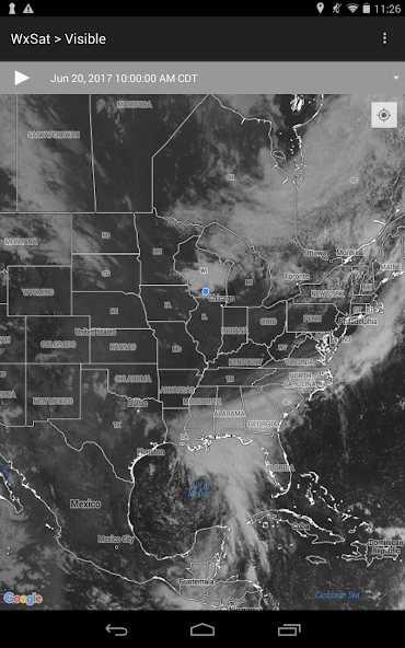
WxSat displays and animates full-resolution, real-time weather satellite data.

WxSat (short for Weather Satellite) displays and animates full-resolution, real-time weather satellite data. WxSat leverages SSEC Data Center holdings to provide global coverage for visible, infrared, and water vapor channels.

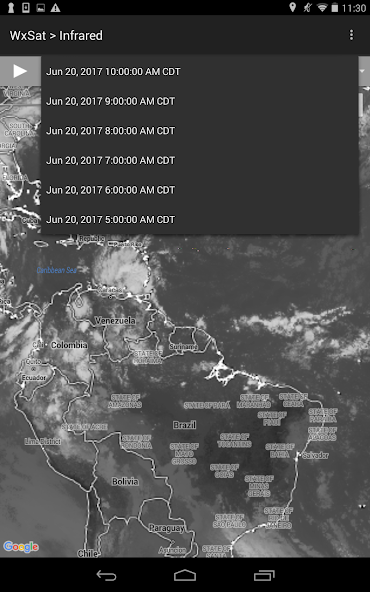
Several geostationary and polar orbiting weather satellites around the globe continuously capture observations of the earth. These data are acquired by the SSEC Data Center which has one of the most extensive collections of real-time and archived weather satellite data in the world. A server dedicated to WxSat blends the images into single hourly global composites for three different products (Visible, Infrared, and Water Vapor). The server stages the most complete hourly images (backfilled when necessary) every hour at 36 minutes past the hour. This allows for a majority of the satellite sources to be included in the composites. These hourly composites are staged for WxSat and form the basis of the animations.

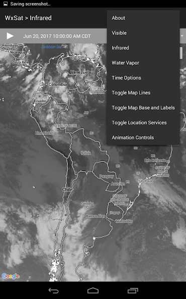
The names of the different images in WxSat refer to the parts of the electromagnetic spectrum the satellite sensors are sampling. The atmosphere is transparent to different types of radiation in certain areas of the spectrum called channels. The three most widely used atmospheric channels are the visible (0.6 microns), infrared (10 to 12 microns), and water vapor (6.5 to 6.9 microns). Scientist combine information provided from all three types of images to forecast the weather, monitor forest fires, ice flows, ocean currents, and long term climate patterns from the unique global perspective that only satellites can provide.

What's New in the Latest Version 1.2.2

Last updated on Jul 5, 2022 Restore satellite data access.
Download(2.98MB)
Users also viewed
  • Taiwan AQI - realtime & push

    Taiwan AQI - realtime & push

    1.0.15 July 7, 2025
  • Magic forest live wallpaper

    Magic forest live wallpaper

    1.1.0.18 July 7, 2025
  • TurnKey-Agent

    TurnKey-Agent

    1.011 July 7, 2025
  • shop level

    shop level

    1.2 July 7, 2025
  • Device Manager

    Device Manager

    3.0.6 July 7, 2025
  • Mahalo Weather

    Mahalo Weather

    1.5.7.1002 July 7, 2025
  • Siaga Bencana

    Siaga Bencana

    v2.4.4 July 7, 2025
  • Jivi App store

    Jivi App store

    1.0 July 7, 2025
  • Offline translator S&T

    Offline translator S&T

    5.0.3.2 July 7, 2025
  • Art Foto Grid Collage

    Art Foto Grid Collage

    1.0.3 July 7, 2025
  • orz Live Wallpaper

    orz Live Wallpaper

    1.10 July 6, 2025
  • Butterfly Theme moonlit aroma

    Butterfly Theme moonlit aroma

    1.7 July 6, 2025
  • ATV Quad Bike Live Wallpaper

    ATV Quad Bike Live Wallpaper

    1.1.1 July 6, 2025
  • MY3Macau

    MY3Macau

    2.3.36 July 6, 2025
  • AppLock | Privacy Protector

    AppLock | Privacy Protector

    3.06 July 6, 2025
About Privacy Policy Terms of Service Cooking Policy

© Copyright 2017-2025 downzq.com