

Hunt, Run, walk, ride, cycle everywhere with your GPS app and offline maps
MaRando GPS is the application created by hikers, for hikers.
Thanks to MaRando GPS, you have more than a GPS in your pocket.
╰┈➤ WHY MaRando GPS ?
Whether you are a hiker, on skis, on horseback, on mountain bike, on bike, on snowshoe, or you practice trail running, running, hunting or picking mushrooms,
MaRando GPS is the essential tool you need.
╰┈➤ MOST
➢ Sound guidance allowing you to follow a route.
➢ Conservation of the history of your courses in an optimized manner (Example more than 500 courses stored). You can find your routes quickly thanks to numerous search criteria such as routes around a city of your choice.
➢ The history of your routes is visible on all your devices via your Google drive and thus guarantees the saving of your routes.
➢ For your safety, sending your GPS position by SMS is available.
➢ Statistics of your travels and performances
➢ Add you ours maps by providing URLs of WMS/WMTS servers.
➢ The altitude difference and distance calculation algorithm has been worked on to be consistent with reality.
╰┈➤ USES / FEATURES
➢ MaRando GPS was designed to be intuitive and you will easily know how to use it.
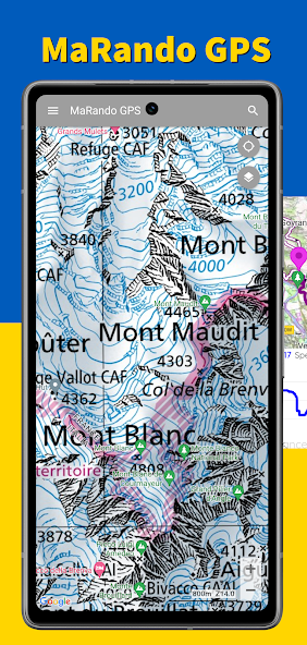
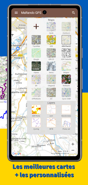
➢ To orient yourself in the field, MaRando GPS indicates your position on quality base maps such as: CalTopo, Thunderforest, French, Spanish, Swiss, Belgian, 4uMap, OpenTopoMap...
➢ Of course, MaRando GPS allows you to record your trip and remains very economical since recording can be done over more than one day.
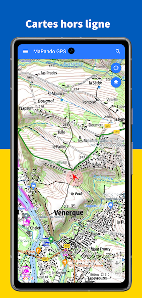
➢ To prepare your trip, you can download the maps of your choice in advance. This action will keep you secure because when you are away from any network, the base cards will remain displayed.
➢ As you progress, you can view the elevation profile on a graph and appreciate: your position, the fact, the rest to do, compare it with another route
➢ From a previously loaded route and thanks to the audio guide, you can listen to direction instructions such as "turn right" or "20 meters behind", "on the route" etc.... To avoid too many messages , the guide only gives you an indication if you leave the course or need to change direction.
➢ All tracks taken in the field or imported will be saved to your device. You can store a very large quantity without disrupting the proper functioning of the application. Numerous search and sorting criteria are available such as the distance of the route, location, proximity to a city, the name of the route, etc.
➢ Each of your routes can be recovered and shared in a GPX file. For each route, you obtain a route profile with movement statistics: breaks, positive or negative elevation, average speeds (with breaks or not), duration of effort, distance etc.... the algorithms calculations are reliable to respond to the reality on the ground.
➢ MaRando GPS offers the retrieval of routes offered from the Utagawa site to import them directly into the application.
➢ MaRando GPS offers aiming to display a target direction on the map in order to determine the target object such as a summit or a town.
➢ Getting started with the application is easy, the “Help” menu is available to help you. Videos are also there to better understand.
➢ Many parameters are available, and the configuration of each of them is accompanied by an explanatory description.
╰┈➤ CONTACT & IMPROVEMENTS
Always wishing to improve our application and keen to provide you with the necessary help, do not hesitate to contact us: [email protected]








 Download