• Home
  • Games
    Action-adventure Simulation Business Role Playing Sports Competition Casual Intelligence Card Strategy Music Rhythm Text Puzzle Flying Shooting Love Development
  • Apps
    Business Office Newsletter Social Life Entertainment Online Shopping Practical Tools Travel Financial Management Educational Learning Information Reading Sports and Health
  • Articles

English 中文(简体) 中文(繁体) 한국어 日本語 Português Español Русский العربية Indonesia Deutsch Français ภาษาไทย
Home Apps Travel Hiking in Attica
Hiking in Attica

Hiking in Attica

1
2
3
4
5
Download
  • Version 2.4
  • Category Travel
  • Package Name anadigit.adventures.attiki_demo
  • Update Time June 7, 2025
  • Size 8.97MB
About this app

A digital topoGuide for 10 hiking routes in 10 different areas of Attica

Hiking in Attica topoGuide is a digital field guide for hikers. It includes routes, descriptions and photos for 10 hiking adventures in 10 different areas of Attica, Greece.

The 10 hikes are:

1. Architectural treasures of Athens

2. Mt. Lycabettus: The classic ascent to the summit

3. Mt. Parnitha: Bafi refuge via the Chouni ravine

4. Mt. Hymettus: A loop walk from Kesariani monastery to Kalopoula

5. Mt. Pendeli: From Dionysus to the ancient quarries

6. Marathon area: Inoi gorge

7. Mt. Pateras: Ascent to the summit

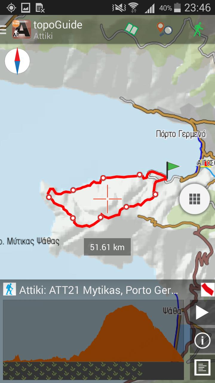
8. Porto Germeno: Crossing Cape Mytikas

9. Hereaion, Loutraki: Sterna-Ireo-L. Vouliagmeni

10. Aegina Isl.: A tour around Paleochora

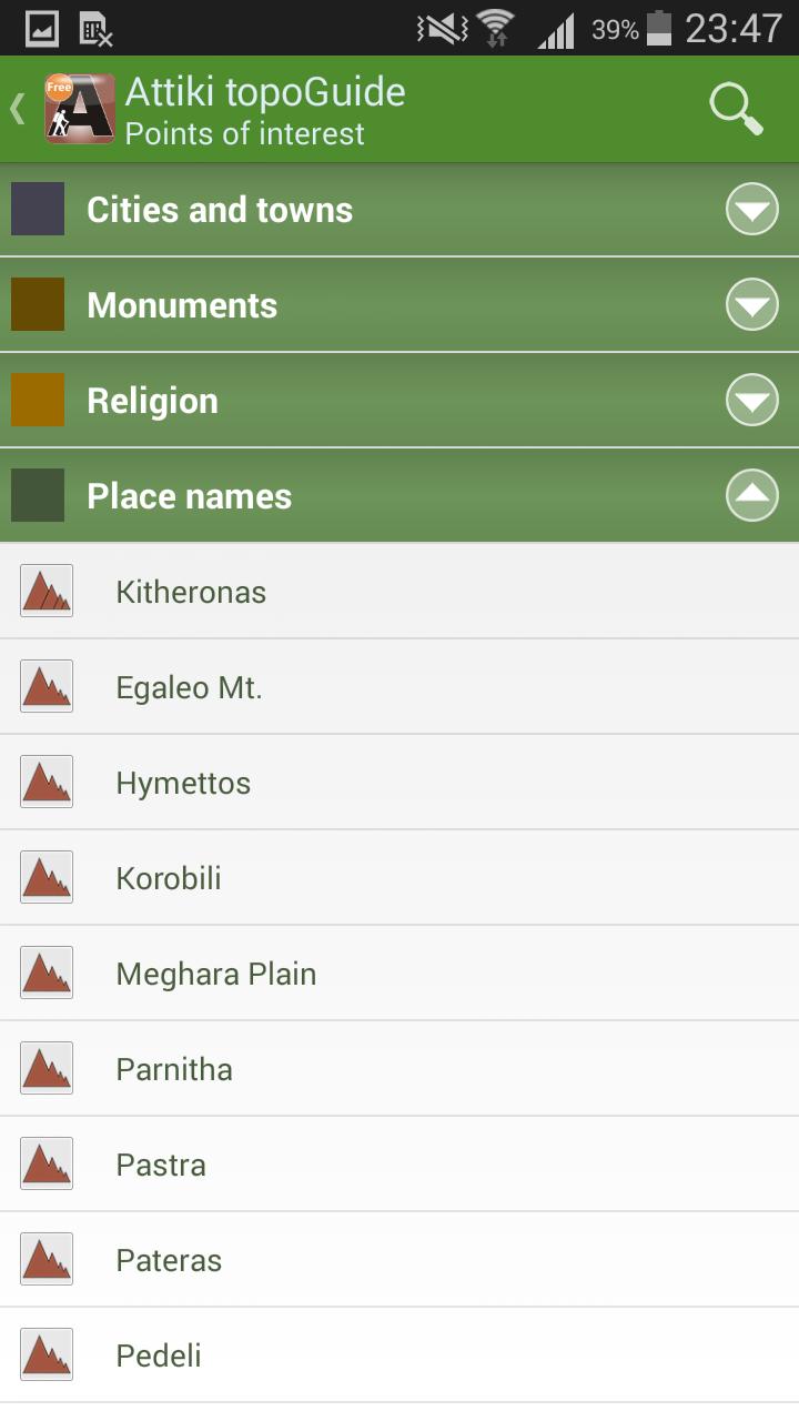
Each Adventure has a description, photos and a POIs list.

The application offers detailed off-line maps and an introduction on each of the areas covered. The app offers also a useful list of POIs with a comprehensive search engine.

The trails list includes easy walks, easy and moderate hiking trails, of a total length of 100 km.

In the field, the application identifies the nearest trail and offer active navigation to it and then along it, with continuous messages to the user, while pops-up photos on every interesting or important terrain feature close to his position. If the hiker position is more than 20 meters far from the trail, the application warns him and suggests how to go back.

The cartographic company AnaDigit, creator of the application, has issued previously hundreds of printed guides and hiking maps for Greece (eg. maps of Crete, Zagori, Sifnos, Naxos and other Aegean islands). All information included in this application and has been recorded during 2015.

What's New in the Latest Version 2.4

Last updated on Nov 4, 2016 Version 2.4 offers downloading off-line maps along the trails and many other improvements and bug fixes.
Download(8.97MB)
Users also viewed
  • Basque Country

    Basque Country

    2.5.7 June 8, 2026
  • Road Guardians

    Road Guardians

    15 June 7, 2026
  • Liberty Carro Conectado

    Liberty Carro Conectado

    1.0.0 June 7, 2026
  • Simple HUD

    Simple HUD

    1.30 June 7, 2026
  • Car Math

    Car Math

    72.0 June 7, 2026
  • Delhi Traffic Police

    Delhi Traffic Police

    1.9.6 June 7, 2026
  • Longueuil RTL Bus - MonTransit

    Longueuil RTL Bus - MonTransit

    24.08.20r2373 June 7, 2026
  • eZhire

    eZhire

    2.0.32 June 6, 2026
  • Tyre Reviews & Ratings

    Tyre Reviews & Ratings

    1.8.0 June 5, 2026
  • donquijote

    donquijote

    1.0.23 June 5, 2026
  • indonesia hotel

    indonesia hotel

    1.0 June 5, 2026
  • Austria Navigation

    Austria Navigation

    1.0 June 5, 2026
  • LinkwithAutomaker

    LinkwithAutomaker

    2.8.2 June 4, 2026
  • Drivelert

    Drivelert

    2.0 June 4, 2026
  • AMB Mobilitat

    AMB Mobilitat

    5.2.14 June 3, 2026
About Privacy Policy Terms of Service Cooking Policy

© Copyright 2017-2026 downzq.com