
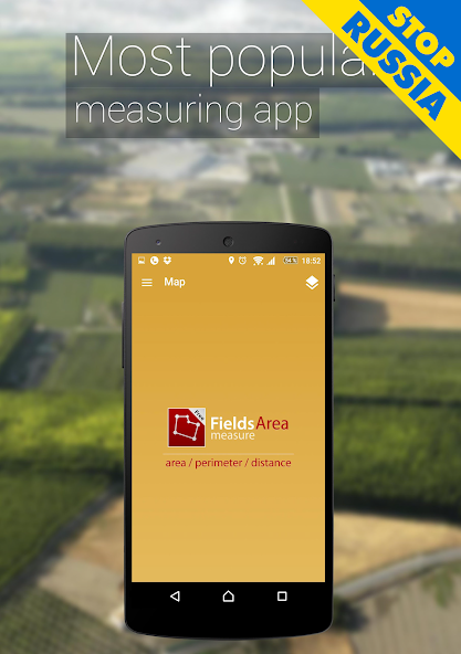
Measure area, distance and perimeter with the greatest tool
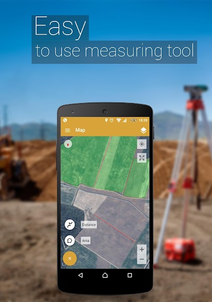
Easy to use, useful app for an area, distance and perimeter management.
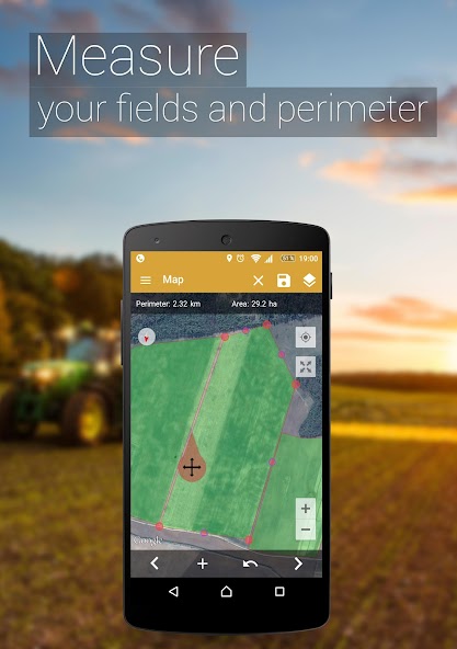
This tool is helping for million people to measure their fields, mark their needed points and sharing their measured maps with their colleagues.
Don't waste your time searching for the best free app to measure area, distance and perimeter - choose our app and simplify the measuring process!
UNIQUE FEATURES:
➜ Fast area/distance marking
➜ Smart Marker Mode for very accurate pin placement
➜ Name, save, group and edit measurements
➜ “Undo” button for all actions
➜ GPS tracking/Auto measure for walking/driving around specific boundaries
It also includes a feature to send an auto-generated link to your friends or partners of pinned/selected area, direction or route – displays the area you want to share.
A feature to add the point of interest or POI on the field helps to avoid stones, mark fences or boundaries of paddocks, graze territories for dairy cows, cattle, beef and other livestock.
In need for more advanced versions?:
❖ PRO version
https://goo.gl/Gh5Jp6
❖ Ad-free version
https://goo.gl/S0u7f1
Try out our other apps for farmers:
❖ Field Navigator
https://goo.gl/hZBnJI
❖ AgroBASE
https://goo.gl/1v0bFt
❖ Soil Sampler
https://goo.gl/6vHwrF
❖ Commodity Spy
https://goo.gl/1f72jm
❖ Calcagro
https://goo.gl/a1jKeM
Disclaimer: Subscription is not included in ad-free or PRO versions, it is an additional feature obtained by an in-app purchase. The mentioned versions influence and expand functionality.
* The app perfectly works with a GARMIN GLO and GARMIN GLO 2 external GPS antennas.
Download it and start measuring your fields today!
GPS Field Area Measure is also useful as a map measurement tool for outdoor activities, range finder applications and sports such as biking or marathon. Comes in handy when exploring golf area or as a golf distance meter, convenient for land surveys, practical for field pasture area measure, helpful in garden and farm work or planning, great to keep area records. It’s great for constructions and agricultural fencing. This application is practical even for solar panel installation, roof area estimation or trip planning.
Our measuring app has the highest accuracy in the market, that being the main reason why we’re the leading measuring app among construction sites, building and farm contractors and farmers.
Among our users are people constructing roofs, buildings and roads, farm owners who are spraying, fertilizing, seeding, harvesting farms or tilling. It’s helpful for biking, traveling or planning trips. For growing gardens and paddock, grass or lawn – we are the number one choice.
Including people who are farming beef, pork, or poultry – the application comes in handy for fence measuring and planning. Pilots can also use this app while flying in the fields. Farm managers and contractors who are exploiting agricultural work for farmers can use this app to count the amount of planted fields and share them with the owner. The fields are displayed in Google Maps.
It's a great tool for paddock calculation and measuring.
This is the best solution for farm owners who grow wheat, corn, rapeseed, maize, sugar beet and need to measure the planted area annually.
All in all, it is useful for:
- Farmers, for farm management
- Agronomists
- Town planners
- Construction surveyor
- Landscape artists
- Land based surveys
- Land record management
- Construction surveys
- Health, Education and facilities mapping
- Farm fencing
- Sports track measurement
- Construction sites and building sites area
- Asset mapping
- Landscape design
- GIS, ArcGIS, ArcMap
 Download