
Transit Mobile app for the city of Santa Cruz de la Sierra, Bolivia
Cruzero
Planning your day!
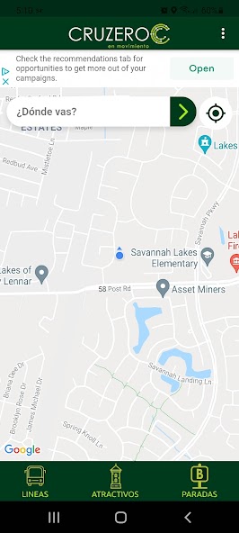
This pioneer application in the city of Santa Cruz de la Sierra, seeks to provide the user a quick and graphical solution to its daily need to get to know what mode of transportation he/she can take from its origin (where it begins its journey) to its destination (which ends its journey), the user can obtain the benefits of planning its travel times while aknowledging the location of different points of interest within the urban area of the city of Santa Cruz de la Sierra.
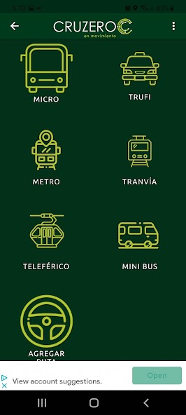
Route calculation by Buses ("Micros")
Over a period no longer than 10 sec. the user gets all the possible options that are available to be transported by bus routes entered in the database, the options shows the travel time, the name or number of the route or routes to take to reach the destination and the route that will describe the chosen option to reach the destination from the origin you have pointed out, the source will be taken from the GPS device's information.
By clicking on the desired routes, you are shown a photograph on how the bus line looks like, to deliver a graphical information about how it looks like the bus you have to take, then by clicking on the "ver ruta" (route view) the user can see the path that describes the bus line to the destination. The results are ordered in such way so that the option with the shortest travel time appears first.
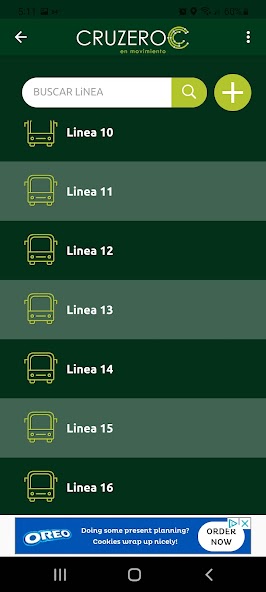
Routes
The user enters the line number to search, by clicking on the button it shows a photograph of the bus, and 2 options above, "Ver Ruta" and "Puntos de interes", ver ruta (route view) shows the path of the bus georeferenced on a map of the city of Santa Cruz, in "puntos de interes" (landmarks) shows the most important landmarks on the selected route along with travel times from point to point, to give the user an idea of the approximate travel time of its trip.
Some landmarks are georefeenced and the user can get to know the location of these points on a map of santa cruz, as well it will ask you how to get to this point, if by taxi or by bus, when the user clicks on any of these options, the application links you with the modules "calculate route on bus" (micros) or "Taxi".
Taxi
In this module the user is shown the same map as to calculate bus routes, showing his georeferenced location via the device's GPS, the user chooses the desired destination, the application will plot the most direct route from its origin to the destination, and show the option "Moviles y tarifas" (taxis and rates) by clicking on this option we get a new screen that shows the distance to the location, approximate travel time and the approximate rate charged by the taxi's service.
Stops
If the user is within the central district area the app will indicate the location of bus stops within 400 meters around your georeferenced location.
By clicking on one of the bus stops it will show the routes that happen to cross close to this location, so the user can see where they can take the desired bus routes, and can perform the same actions that are allowed in the module "Routes"
By clicking on "Puntos de interes" (Landmaks) will reach a simple search, where you can look by letters that are included in the name of the landmarks or just click on "buscar" (search) to display all of the landmarks.
Landmarks
In this module the user can search for landmarks by categories, and you can access detailed information on the sites listed there, will give you the option to reach these places either by taxi or bus, linking this with the modules "Taxi" and "calculate bus route"
 Download